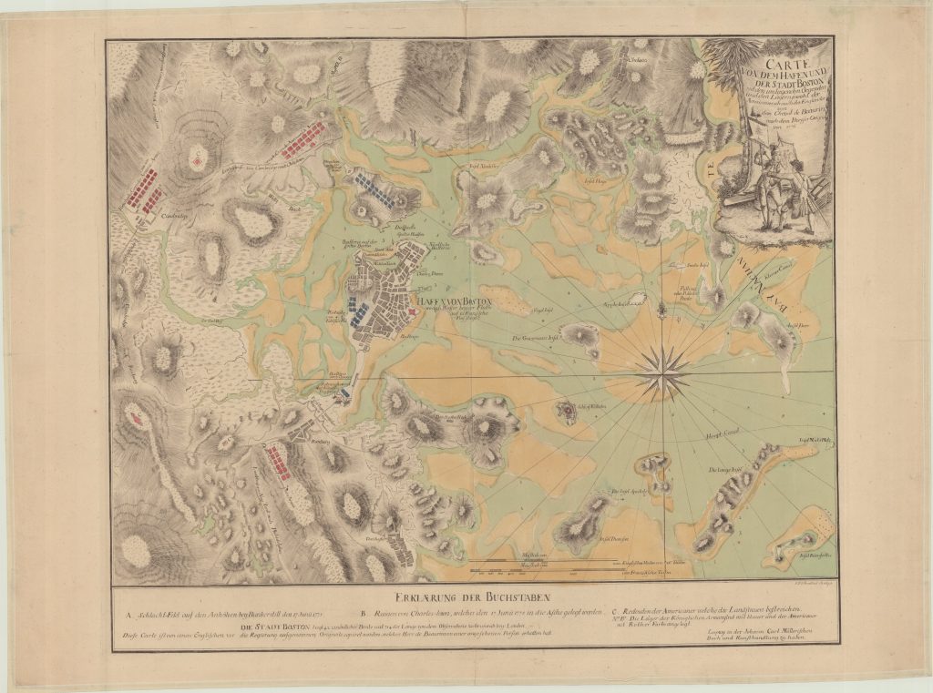
CARTE VON DEM HAFEN UND DER STADT BOSTON mit den umliegenden Gegenden und den Lägern sowohl der Americaner als auch der Engländer Boston hadtörténelmi térkép 1775/1776
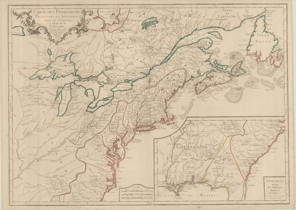
CARTE DES POSSESSIONS FRANÇOISES ET ANGLOISES DANS LE CANADA, et Partie de la LOUISIANE Észak-Amerika (brit és francia gyarmatok) általános térkép 1756
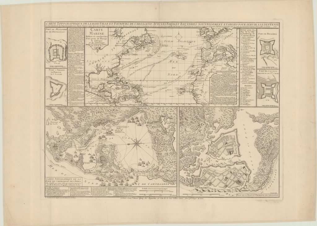
CARTE TOPOGRAPHIQUE DE LA BAYE VILLE ET FAUBOURG DE CARTRGENE AVEC LES FORTS ET BATTERIES NOUVELLEMENT ETABILES POUR SERVIR A SA DEFFENSE Cartagena (Kolumbia) hadtörténelmi térkép 1741
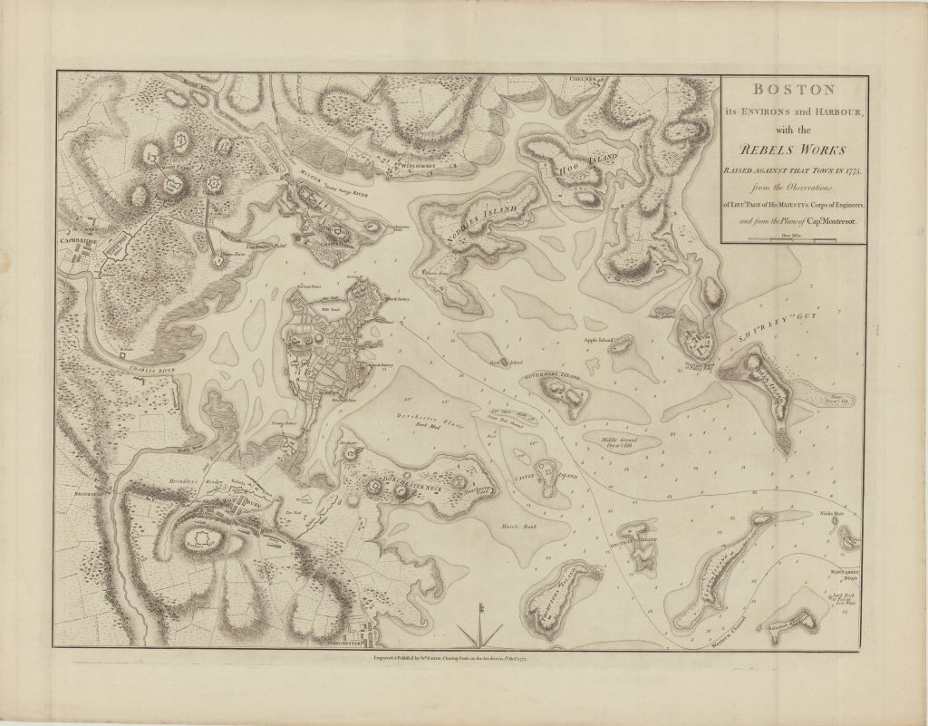
BOSTON, its ENVIRONS and HARBOUR, with the REBELS WORKS RAISED AGAINST THAT TOWN IN 1775, from the Observations of LIEU.T PAGE of MAJESTY’S Corps of Engineers, and from the Plans of Cap.t Montresor Boston hadtörténelmi térkép 1775
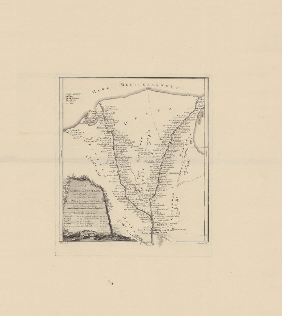
NILI BRACHIA AMBO MAJORA cum Oppidis et Vicis in utraque ripa sitis Nílus-delta általános térkép 1774
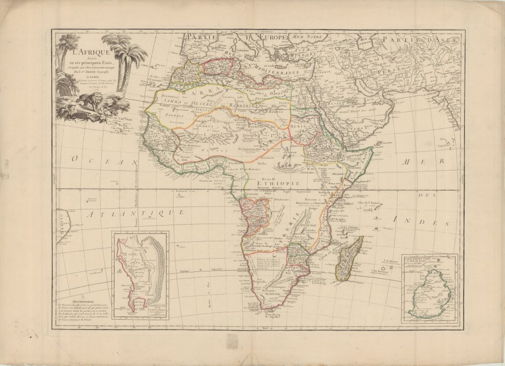
L’AFRIQUE divisée en ses principaux Etats, assujettie aux Observations Astronomique Afrika általános térkép 1769
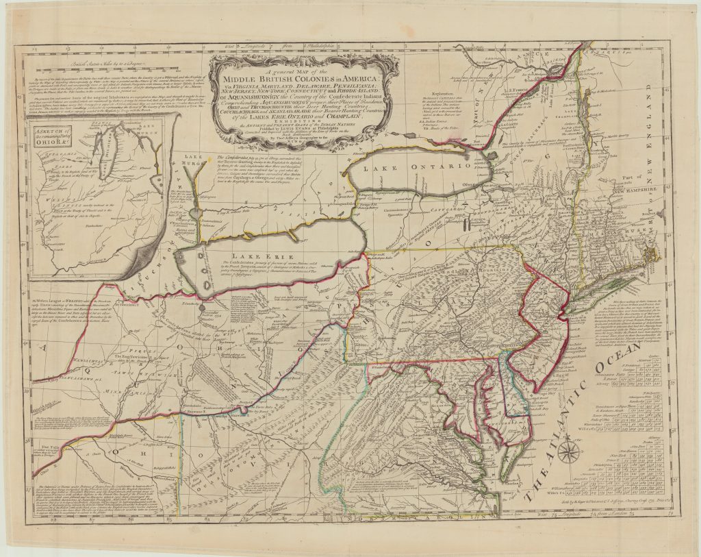
A general MAP of the MIDDLE BRITISH COLONIES in AMERICA: Viz. VIRGINIA, MARYLAND, DELAWARE, PENSILVANIA, NEW-JERSEY, NEW-YORK, CONNECTICUT and RHODE-ISLAND, Of AQUANISHUONIGY the Country of the Confederate Indians, Comprehending AQUANISHUONIGY proper, their Places of Residence, OHIO and THUCHSOCHRUNTIE their Deer Hunting Countries, COUCHSACHRAGE and SKANIADARADE their Beaver Hunting Countries, Of the LAKES ERIE, ONTARIO and CHAMPLAIN, EXHIBITING the ANTIENT and PRESENT SEATS of the INDIAN NATIONS Tizenhárom gyarmat (észak) általános térkép 1775
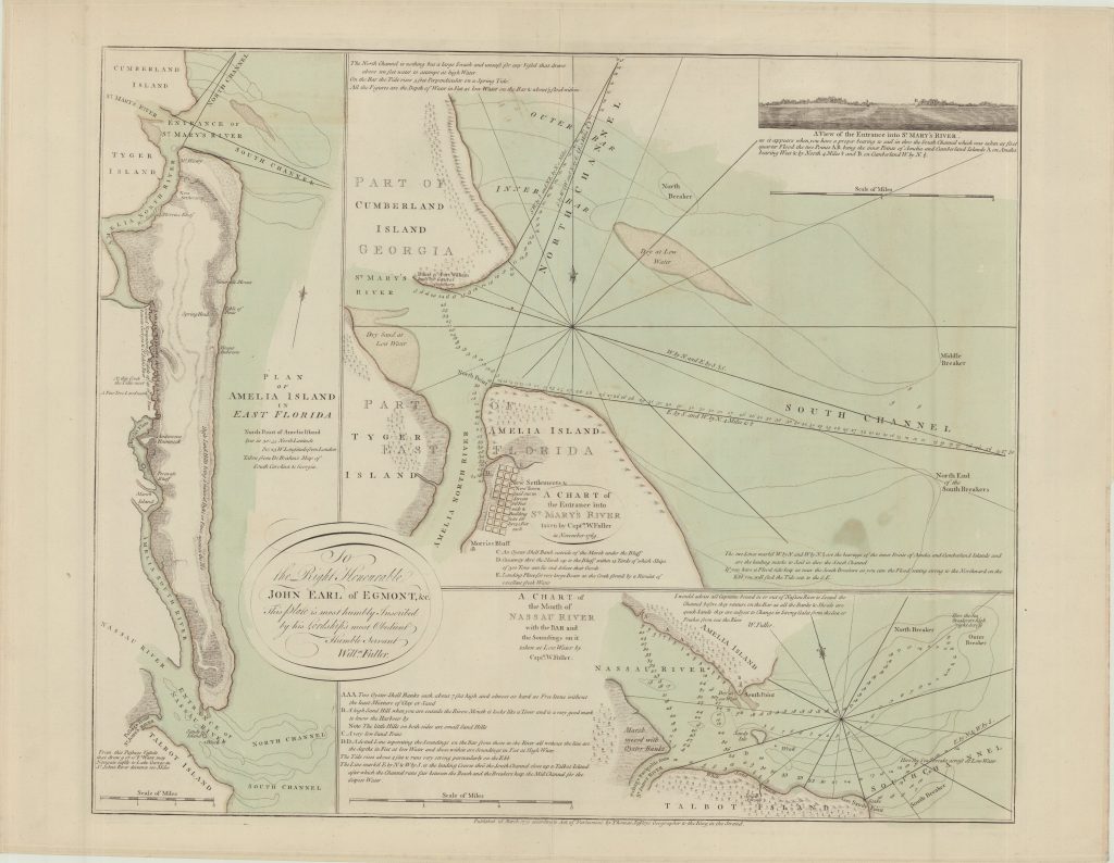
PLAN OF AMELIA ISLAND IN EAST FLORIDA Amelia-sziget, Nassau (folyó), St. Marys (folyó) közlekedési térkép 1770
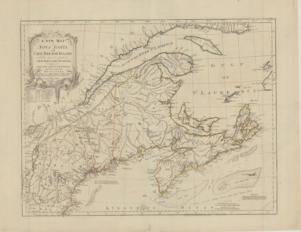
A NEW MAP of NOVA SCOTIA, and CAPE BRETON ISLAND with the adjacent parts of NEW ENGLAND and CANADA, Új-Anglia, Új-Skócia és Cape Breton-sziget általános térkép 1775
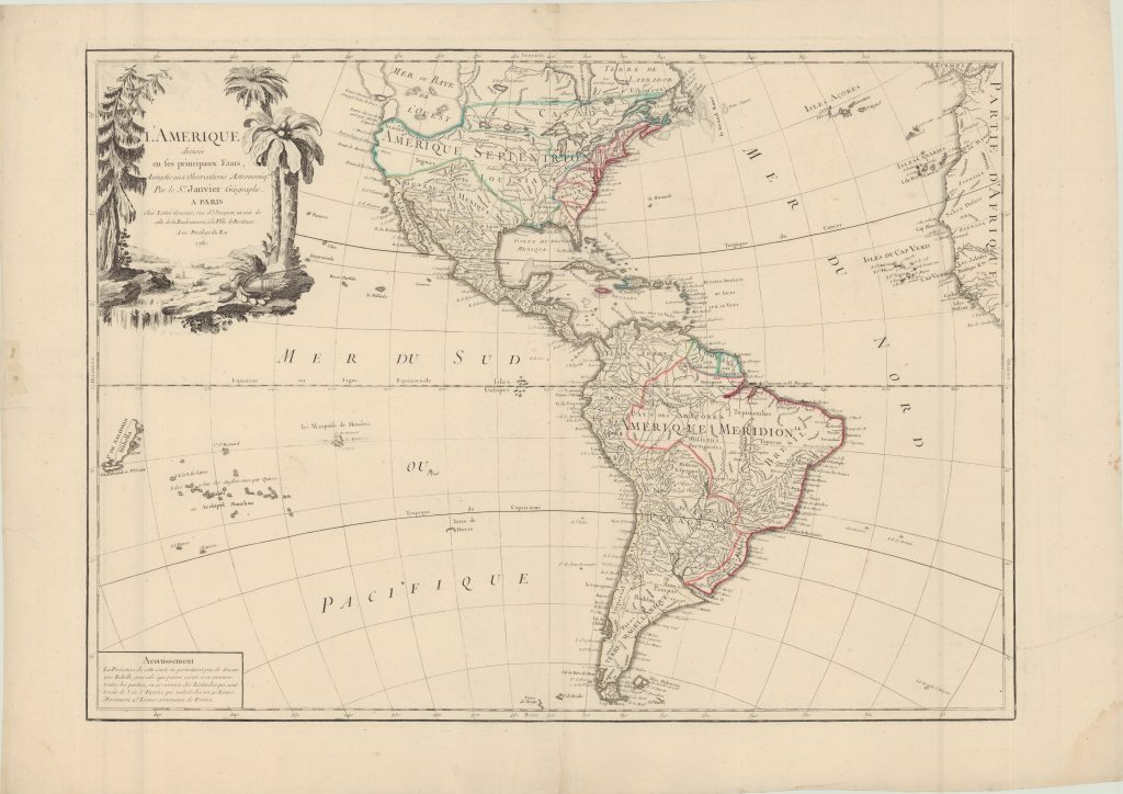
L’AMERIQUE divisée en ses principaux Etats Assujetie aux Observations Astronomiqu.es Amerika általános térkép 1760
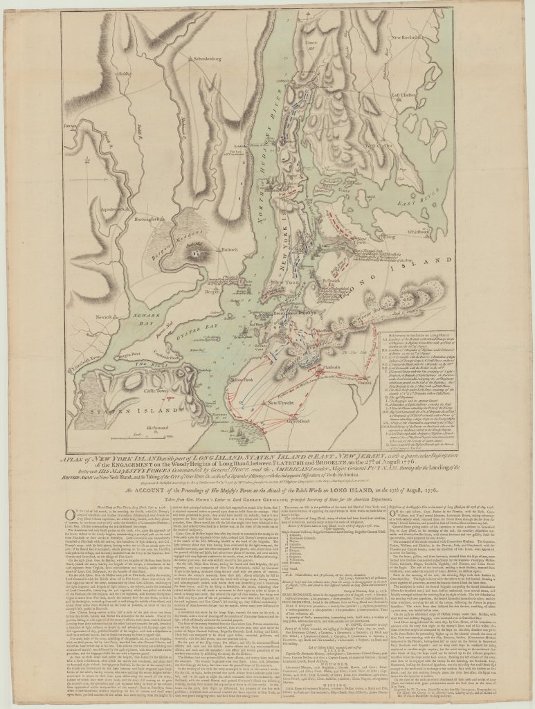
A PLAN of NEW YORK ISLAND, with part of LONG ISLAND, STATEN ISLAND & EAST NEW JERSEY, with a particular Description of the ENGAGEMENT on the Woody Heights of Long Island, between FLATBUSH and BROOKLYN, on the 27.th of August 1776. between HIS MAJESTY’S FORCES Commended by General Howe and the AMERICANS under Major General PUTNAM, New York (környék) hadtörténelmi térkép 1776
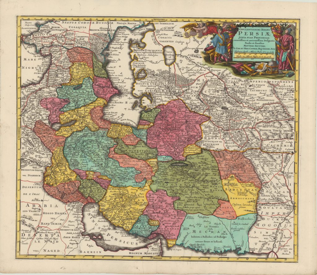
OPULENTISSIMI REGNI PERSIÆ JUXTA SUAS PROVINCIAS recentissima et accuratissima Designatio, Perzsia általános térkép 1731/1740
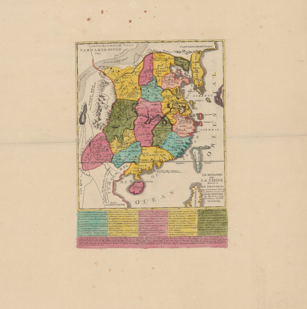
LE ROYAVME DE LA CHINE Diviseé EN PROVINCES ou sont marqué dvne + les Androis ou il y a des EGLISES CHRESTIEN des Misions et des Residances des R. P. JESUISTE Kína közigazgatási térkép 1655/1735
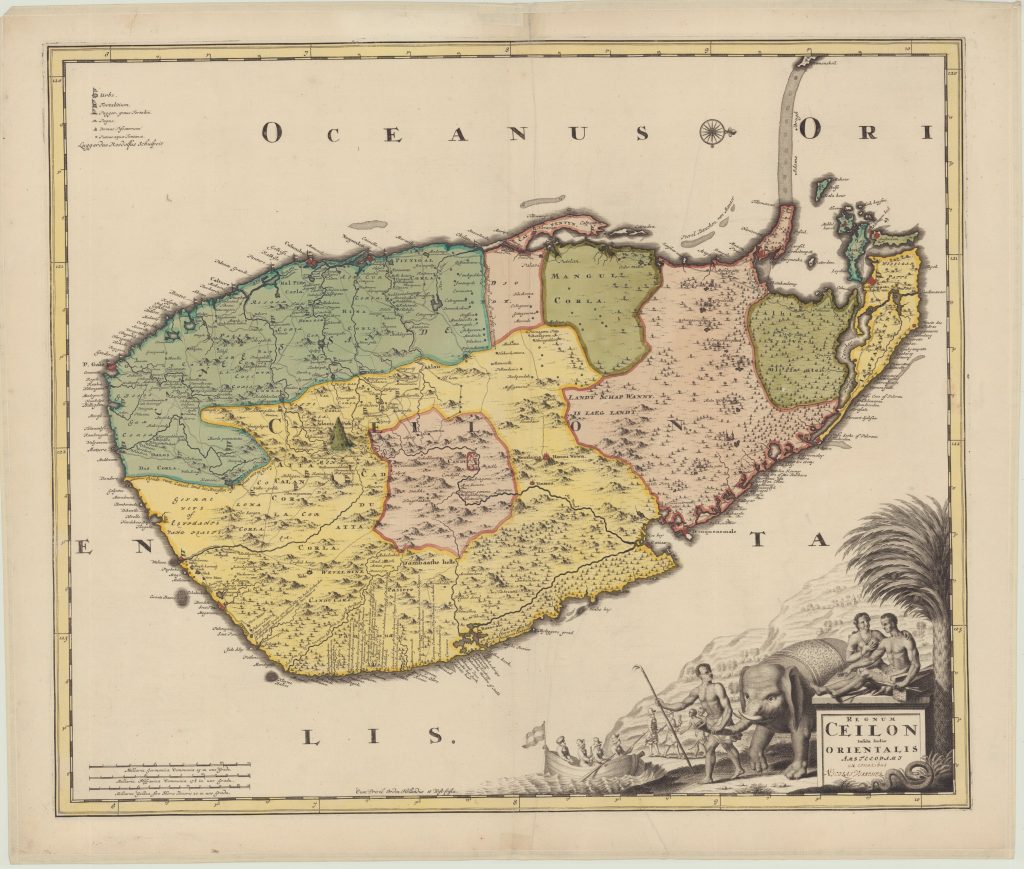
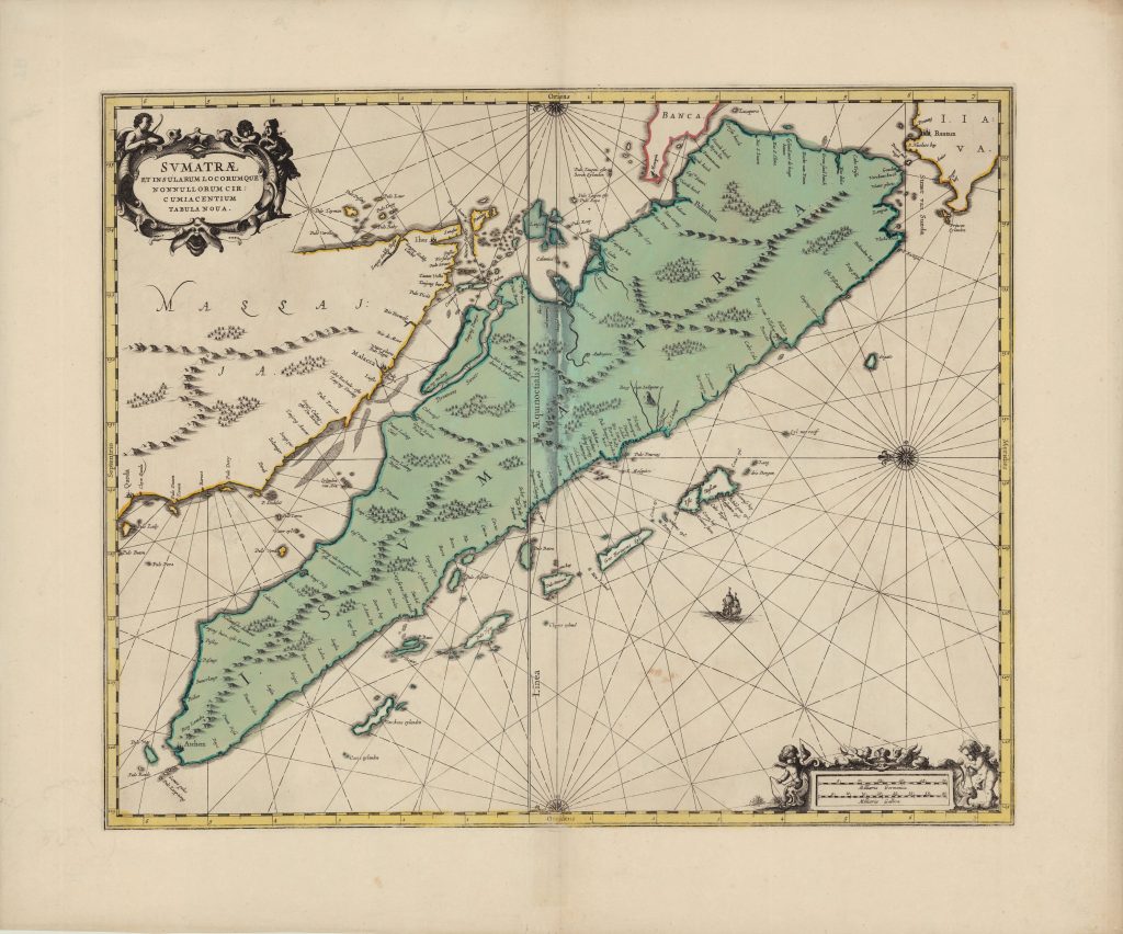
SVMATRÆ ET INSULARUM LOCORUMQUE NONNULLORUM CIRCUMIACENTIUM TABULA NOUA. Szumátra általános térkép 1659
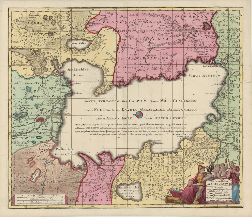
Nova et accuratissima MARIS CASPII hactenus maximam partem nobis non satis cogniti ac Regionum adjacentium Kaszpi-tenger (vidék) általános térkép 1710/1725